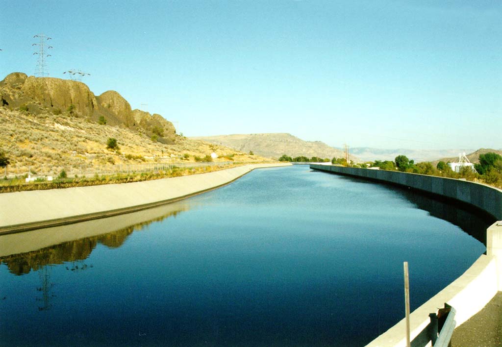
Water for the project comes from Lake Roosevelt, the reservoir formed behind the Grand Coulee dam. Water pumped from lake Roosevelt is deposited into the Upper Grand Coulee above and to the west of the dam. Earthfill dams at the north and south end of the coulee contain the water forming Banks Lake. At Coulee City on the south end of the lake water is allowed to flow into the Main Canal, a series of unlined and lined channels, tunnels and siphons which terminate at Billy Clap lake, a six mile long reservoir formed by Pinto Dam. Water from the main canal is further diverted into the East Low Canal and the West Canal which more or less form the east and west boundries of the upper irrigation project. Water from these canals is further distributed over the region by a series of smaller canals, tunnels, and siphons. Excess water from the upper part of the project is directed through a series of wasteways into the Potholes Reservoir south of Moses Lake. This large reservoir, formed by O'Sullivan Dam, provides the irrigation water for the lower half of the project. The lands of the southern half of the project are drained by a series of wasteways which empty back into the Columbia river near Pasco, WA.
The extensive network of canals, tunnels, reservoirs, and pumping plants which make up the project currently provide water to over half a million acres. With additional canals and pumping facilities the project has the potential to irrigate over 1 million acres of Columbia basin farmland.

The water for the Columbia Basin Irrigation Project comes from Lake Roosevelt via the pump/generator plant at Grand Coulee dam. This facility, located on the west upstream side of the dam, lifts water from the reservoir up 280 feet into the Banks Lake feeder canal above the river gorge.
Construction of the pumping plant began with the original dam construction in the thirties but was delayed by the onset of World War II when power generation was given highest priority. After the war construction was resumed and the plant was finally made operational in 1951. The first irrigation water was delivered in June of the following year.
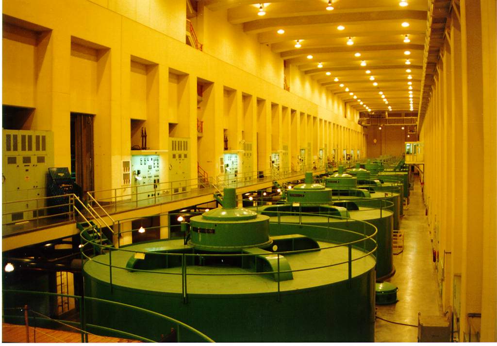
At the time of original construction the pumping plant contained six 65,000 horsepower pumps. In 1973 work began on extending the plant. The pump bay was doubled in length to the south and six 67,500 horsepower pump/generators were added (the last in 1983) providing 12 pumps in all.
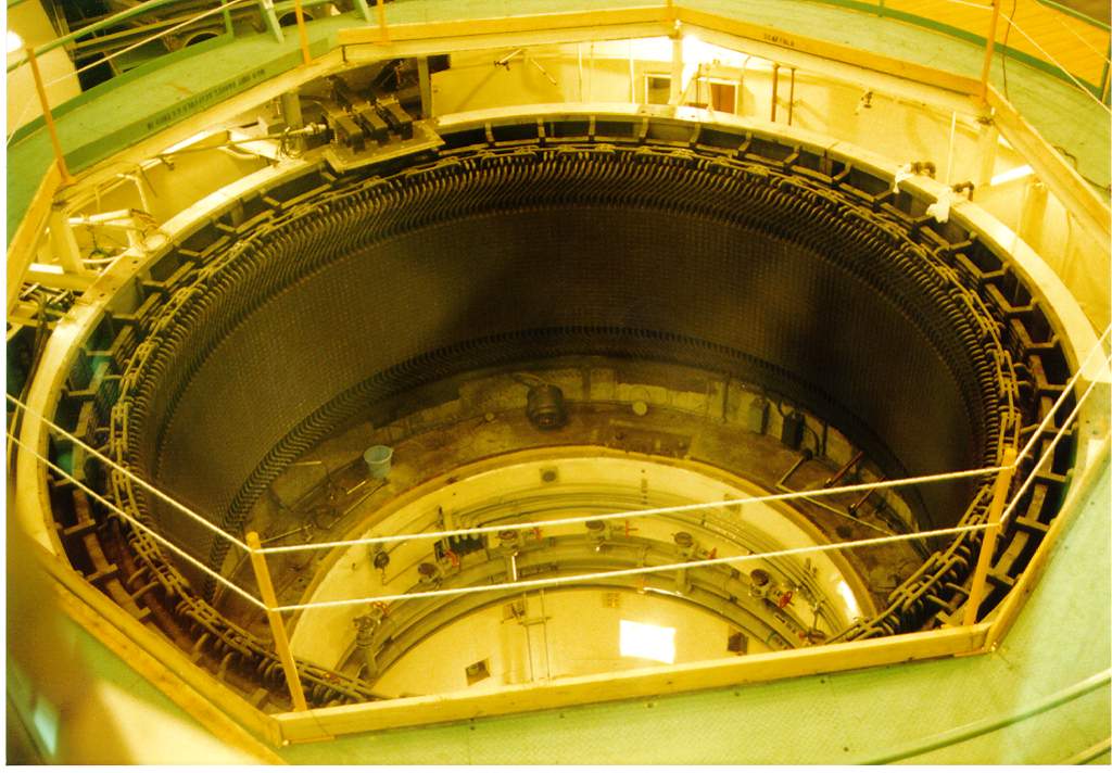
Each pump lifts water from Lake Roosevelt up through a 12 foot diameter discharge pipe to the feeder canal above. For most of their length the discharge pipes are buried in the rocky cliff to the west but at the top of the hill they emerge and can be seen as 12 silver pipes leading to the headworks of the feeder canal. The original pumps can supply water to the feeder canal at a rate of 1,600 cubic feet of water a second while the newer units can supply 2,000 cubic feet of water a second. They also have the advantage of being reversible. During times of peak power need the new pumps can be reversed thus turning them into generators. Water flows back down through the outlet pipes, through the generators and into Lake Roosevelt. When opearting in this mode each pump can produce 50 megawatts of electrical power.
The original pump-only units get their power from direct connections to generators in the Dam's left powerhouse. One generator can supply enough power to run two pumps. Therefore, during the pumping season, three left powerhouse generators are dedicated to the task of powering six pumps. The six pump/generators, on the other hand, are not connected to dedicated generators but instead get their power from the switchyard above the dam. This allows them to draw power from the grid when operating as pumps and supply power to the grid when opearting as generators.
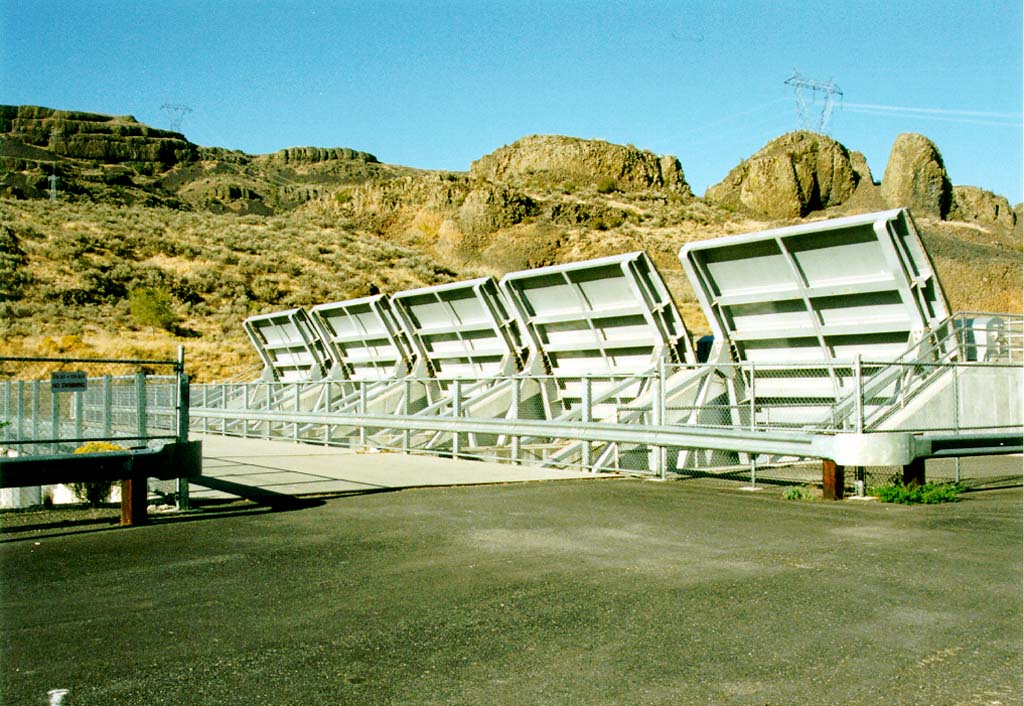

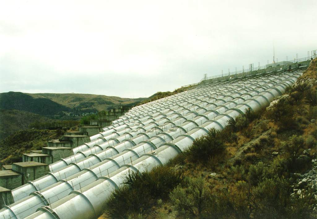
The Feeder Canal is a concrete lined canal which runs from the outlet of the pumping plant discharge tubes to the north end of Banks Lake (see below). The original canal was completed in 1951 but has since been widened to accomodate the extra water available from the six new pump/generators added to the pumping plant. The canal is 1.8 miles in length, 25 feet deep and 80 feet wide at the base. It has the capacity to carry 16,000 cubic feet of water per second. Located near the Banks Lake end of the canal are five steel check gates which can be used to isolate the canal from the lake. These make it possible to drain the canal for maintenance or repair.
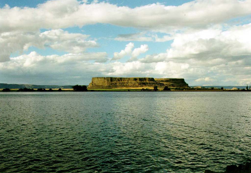
Banks lake is the equalizing reservoir for the upper section of the irrigation project. It is named after Frank A. Banks, chief construction engineer of Grand Coulee dam. Banks lake lies in the floor of the Upper Grand Coulee and is bounded by the coulee walls on the east and west and by dams on the north and south. The lake is 27 miles in length and runs from the city of Grand Coulee in the north to Coulee City in the south. It contains 1,275,000 acre-ft of water of which 715,000 acre-ft are available for irrigation. The lake is maintained by water flowing in from the Feeder canal (see above). Water is removed for irrigation via the Main canal at Coulee City.
Each of the two earthfill dams forming the ends of the lake are of similar construction consisting of layers of clay, sand, gravel, and rocks. North Dam, located at Grand Coulee, is 30 feet wide at the top, 1000 feet wide at the base (maximum), 145 feet high and 1,450 feet long. Dry Falls Dam, at Coulee City, is 42 feet wide at the top, 480 feet wide at the base (maximum), 123 feet high and 9,800 feet long. U.S. highway 2 runs along its top and intersects state highway 17 at its east end. Water released through Dry Falls dam travel through the Bacon siphons and tunnels and eventually into Billy Clapp lake.
For more information on irrigation in Washington State visit the Washington State Water Resources Association home page!
| Created: | September 28, 1995 |
|---|---|
| Modified: | September 5, 1997 |