Grand Coulee Dam Photo Gallery

(Irrigation Project Page)
Pictures of canals, reservoirs, re-lift pumps, wasteways and other components related to the irrigation
project. All photos are stored in JPEG format to provide good color and image quality in a minimum amount of space. Photos are 1024 pixels in length measured on the long axis and take up approximately 100kB of storage.
All photos were taken by the author unless otherwise noted.
 74kB JPEG (1024 x 708)
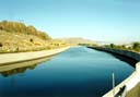
Banks Lake Feeder Canal:
This is a picture of the Banks lake feeder canal taken in September of '95. The view is from the north end of Banks lake looking back up the canal towards the dam. The canal is 80 feet wide at the base, 25 feet deep and can carry 16,000 cubic feet of water a second. This photo was taken at the end of the irrigation season when none of the pumping plant units were operating. When the pumps are running the water in the canal is quite turbulent.
 157kB JPEG (1024 x 706)
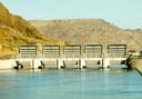
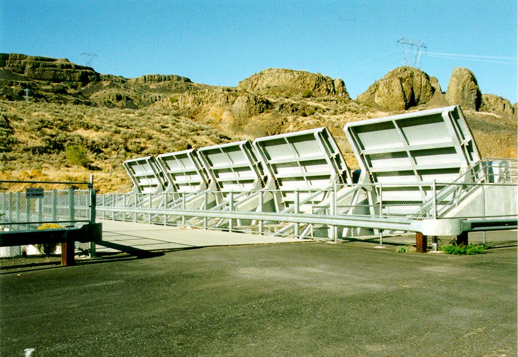
Feeder Canal Check Gates (image 1):
This is a shot of the feeder canal check gates located about 200 yards east of the canal terminus. Here the gates are shown in their raised position. Each of the five gates is 24 feet wide and 25 feet tall. With the gates closed the canal can be drained for servicing.
 93kB JPEG (1024 x 711)
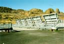
Feeder Canal Check Gates (image 2):
This is another shot of the check gates taken from the mouth of the canal.
 83kB JPEG (1024 x 706)
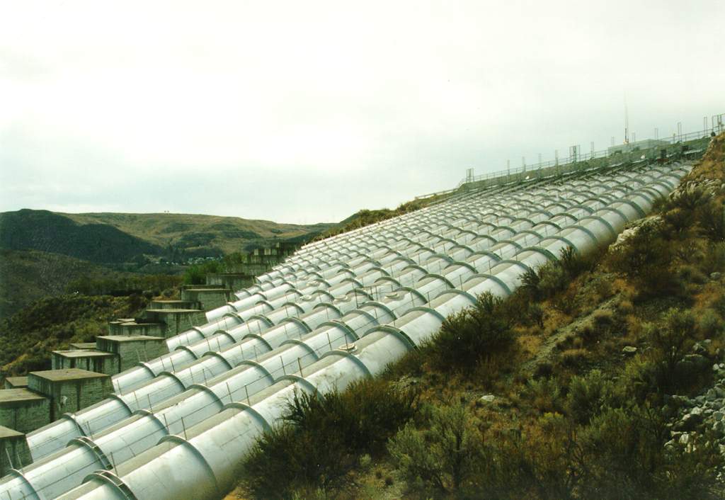
Pumping Plant Discharge Tubes:
This is a view looking south over the 12 pumping plant discharge tubes. Each of these tubes is 12 feet in diameter and carries water from Lake Roosevelt below to the headworks of the Banks Lake feeder canal above.
 108kB JPEG (1024 x 708)
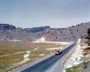
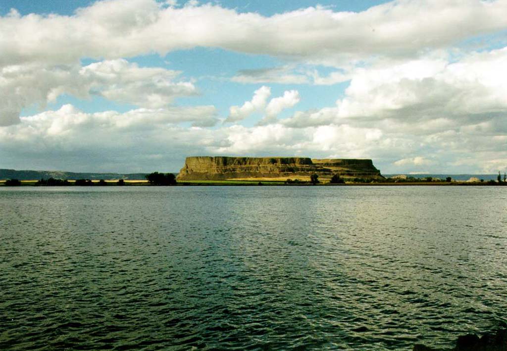
Steamboat Rock:
This shot was taken from state highway 155 which runs along the east side of Banks Lake. In the distance can be seen Steamboat Rock, a prominent feature in the Upper Grand Coulee. Since the filling of Banks Lake in 1951 Steamboat Rock has very nearly become an island. It is connected to the east shore by a very narrow strip of land which is off the frame to the left.
 95kB JPEG (1024 x 790)
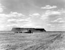
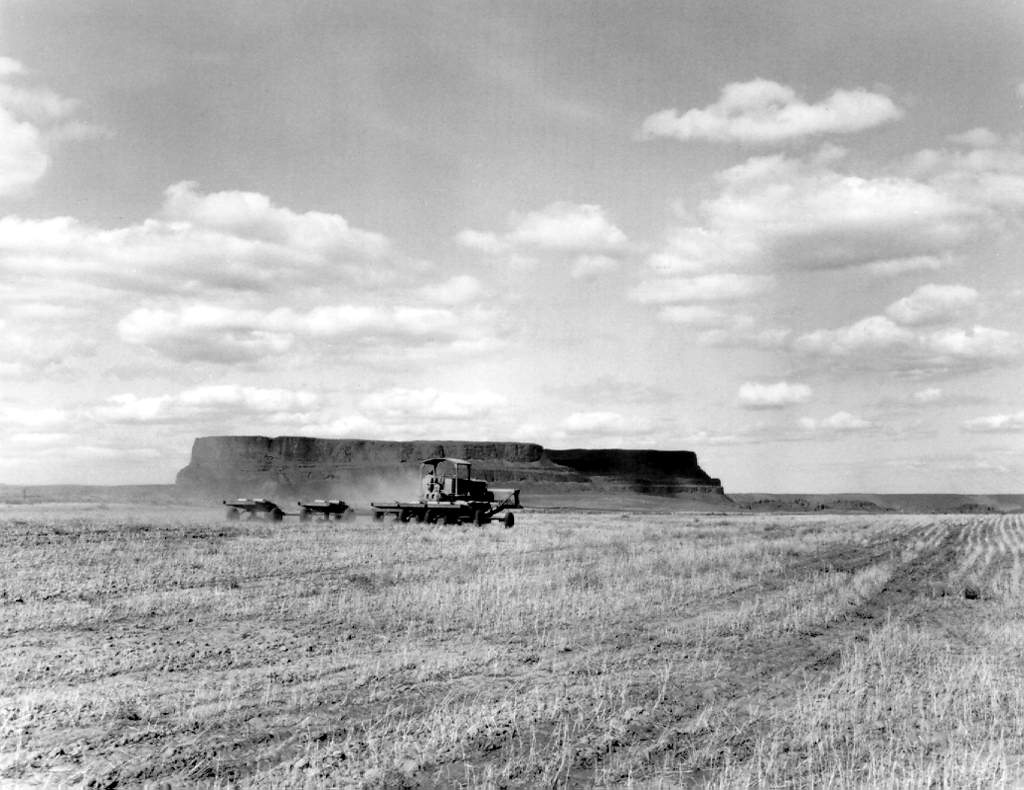
Steamboat Rock (before flooding):
A view of a wheat field with Steamboat Rock in the background before the land was flooded to become Banks Lake. This photo was taken in April of 1950. Photo courtesy of the U.S. Bureau of Reclamation.
 90kB JPEG (1024 x 825)
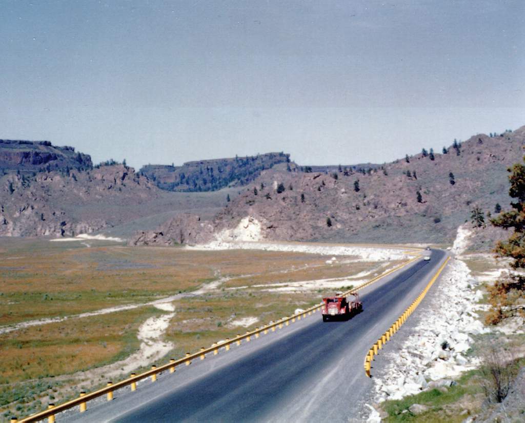
State Route 155 / Upper Grand Coulee:
This is a shot of state highway 155 which runs along the east side of the Upper Grand Coulee. This photo was taken 1951 shortly before the coulee was filled with water to form Banks Lake. Photo courtesy of the U.S. Bureau of Reclamation.
This page is maintained by Charles Hubbard as a private effort. Mr. Hubbard is in no way associated with the U.S. Bureau of Reclamation or the Columbia Basin Project.
| Created: |
September 19, 1995 |
| Modified: |
April 20, 1996 |
 74kB JPEG (1024 x 708)
 157kB JPEG (1024 x 706)
 93kB JPEG (1024 x 711)
 83kB JPEG (1024 x 706)
 108kB JPEG (1024 x 708)
 95kB JPEG (1024 x 790)
 90kB JPEG (1024 x 825)